SOVEREIGN NAVIGATION · PATENT PENDING GB2615113.4
Mars NavCore®: three models, one navigation core
Mars NavCore® keeps navigating when satellite signals are jammed, spoofed or unavailable. Passive star and sun sensing is fused in real time with authenticated satellite positioning and inertial sensing.
Choose a model
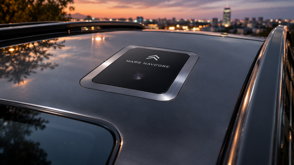
MODEL 01 · VEHICLE
Mars NavCore® Automotive
For car manufacturers, land vehicles, convoys and autonomous ground platforms. Flush-mounted in a vehicle cradle.
| Mounting | Vehicle cradle, horizontal |
|---|---|
| Navigation technology | Star tracker (night), high-precision solar sensors (day), authenticated GNSS, 9-axis inertial, inbuilt atomic clock precision |
| Position resolution | 150–200 mm (digital) |
| Satellite positioning | Authenticated GNSS, integrated sky-facing antenna |
| Display | OLED |
| Battery | 3.7 V Li-ion polymer, 2000 mAh |
| Footprint | Approx. 60 × 60 mm (TBC) |
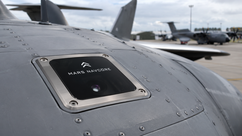
MODEL 02 · AIRCRAFT
Mars NavCore® Aviation
For aircraft manufacturers and operators: fixed-wing and rotary aircraft and UAVs. Flush-mounted in an aircraft cradle.
| Mounting | Aircraft cradle, horizontal |
|---|---|
| Navigation technology | Star tracker (night), high-precision solar sensors (day), authenticated GNSS, 9-axis inertial, inbuilt atomic clock precision |
| Position resolution | 150–200 mm (digital) |
| Satellite positioning | Authenticated GNSS, integrated sky-facing antenna |
| Display | OLED |
| Battery | 3.7 V Li-ion polymer, 2000 mAh |
| Footprint | Approx. 60 × 60 mm (TBC) |
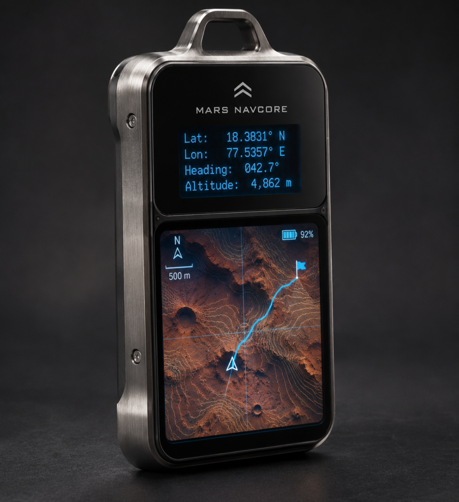
MODEL 03 · PERSONAL
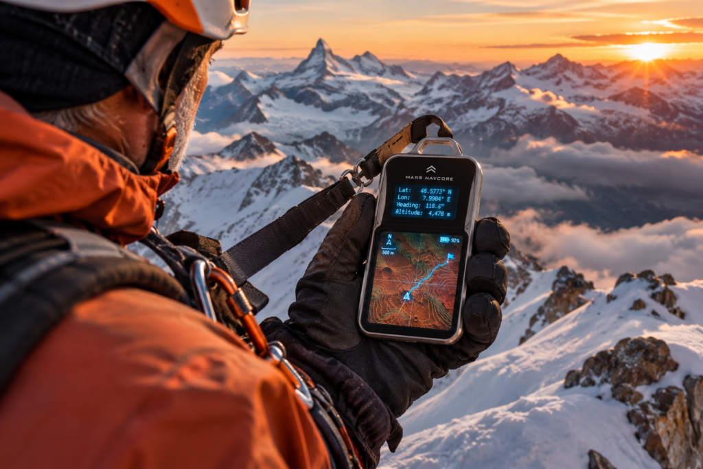
Mars NavCore® Handheld
For forestry and rail workers, emergency personnel, campers, hikers and bush walkers. Works in any orientation.
| Carry | Aluminium frame down both sides, joining in a loop at the top for a bandolier or utility-belt clip |
|---|---|
| Navigation technology | Star tracker (night), high-precision solar sensors (day), authenticated GNSS, 9-axis inertial, inbuilt atomic clock precision |
| Position resolution | 150–200 mm (digital) |
| Satellite positioning | Authenticated dual-band GNSS, orientation-independent antenna |
| Display | Colour touchscreen with night mode |
| Battery | 3.7 V Li-ion polymer, 4000 mAh, 14.8 Wh |
| Front face | Approx. 126 × 60 mm, low profile (TBC) |
How it finds its position
Mars NavCore® ranks its sources by authority. The star fix always takes precedence, and every other source is checked against it.
- 1 · HIGHEST AUTHORITYStar fixAt night, the star tracker matches the visible star field to its catalogue and fixes position and heading. Passive, unjammable and unspoofable.
- 2 · DAYSolar fixBy day, high-precision sun sensors measure the sun’s altitude and azimuth. Combined with atomic-clock-precision timing, this gives latitude and longitude.
- 3 · CHECKEDAuthenticated GNSSThe satellite receiver authenticates signals and detects spoofing and jamming. Suspect signals are rejected, never trusted over a celestial fix.
- 4 · CONTINUOUS9-axis inertialInertial sensing carries the position between fixes, so navigation continues through cloud, tunnels and signal loss.
Hardened against interference
Built for contested environments where satellite signals are attacked and electronics are targeted.
- Spoofing and jamming detectionAuthenticated satellite receiver flags and rejects false or jammed signals.
- Fibre-optic data linkAutomotive and Aviation models send data to the Tail unit over optical fibre, immune to electromagnetic interference.
- EMP and microwave jammingDesigned to resist electromagnetic pulse and high-power microwave jamming (test evidence TBC).
- Emissions securityNo intentional RF emissions. Designed to TEMPEST principles (certification TBC).
Common to every model
| Navigation sources | Star tracker (night), high-precision solar sensors (day), authenticated GNSS, 9-axis inertial, inbuilt atomic clock precision |
|---|---|
| Sensor fusion | Extended Kalman filter, real time |
| Signal-denied operation | Celestial and inertial navigation continue without GNSS |
| Position resolution | 150–200 mm (digital) |
| Anti-spoofing | GNSS signal authentication with spoofing and jamming detection |
| Position update rate | TBC |
| Time to first fix | TBC |
| Signature | Non-illuminating, fully passive sensing |
|---|---|
| RF emissions | No intentional RF emissions in normal operation |
| EMP and microwave | Designed to resist electromagnetic pulse and microwave jamming (test evidence TBC) |
| Emanations security | Designed to TEMPEST principles (certification TBC) |
| Charging | USB cradle or inductive charging cradle |
| Operating temperature | Sensor head and electronics: −40 °C to +140 °C. Heat from the power electronics prevents frosting. |
| Battery temperature | Kept within the cell maker’s rating by internal heating and thermal management (range TBC) |
| Origin | Designed and manufactured in the UK |
How it connects
The Automotive and Aviation models mount flush with the vehicle roof or airframe skin. Navigation data leaves the unit over an optical fibre, so no electrical cable passes through the sensor head. At the other end, a small Tail unit converts the data for the platform’s own bus.
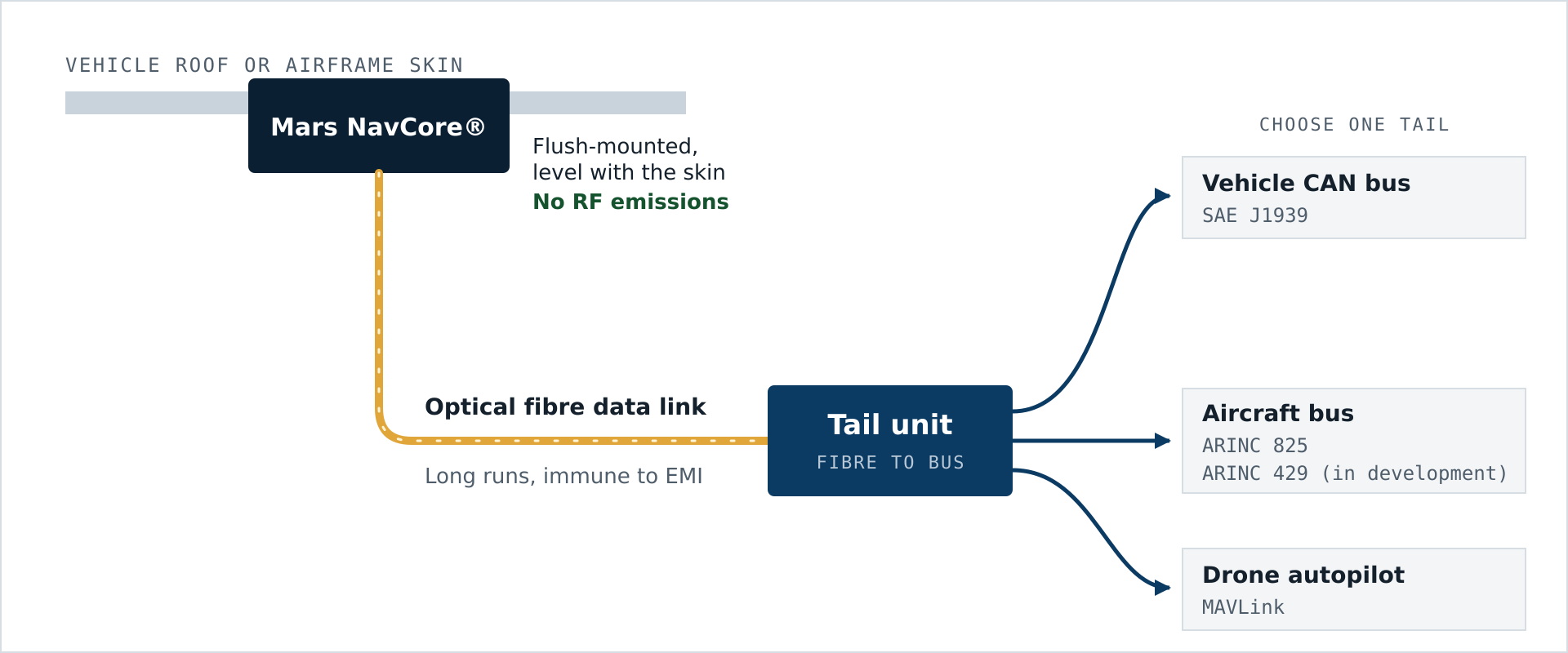
Tail unit options: vehicle CAN bus (SAE J1939), aircraft bus (ARINC 825 • ARINC 429 (in development)), or drone autopilot (MAVLink). Other data-bus interfaces are available on request. Interface details are available to integrators under NDA.
No Man Lost or Left Behind
Every Mars NavCore® model includes the BML No Man Lost or Left Behind system for personnel recovery. It helps BML locate a person carrying or wearing the unit so they can be brought home. It does not broadcast the user’s position continuously.
Further details are available to qualified customers under NDA.
Specification books and pre-orders
Full specification books are available to customers and integrators on request. Detailed engineering and interface information is shared under NDA.